Structure of the Earth
the “sensation” of Göttingen
Seismology & Geophysics
Structure of the Earth
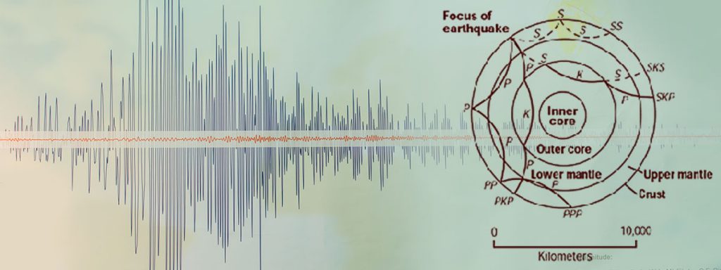
“While comparing the recordings from Samoa and Göttingen, Beno Gutenberg (see Persons) detected strange, previously unknown reflections in the seismograms. Following extensive calculations, he interpreted them as reflections of the seismic waves at a boundary layer that is located at a depth of about 2,900 km in the Earth’s interior. When Gutenberg published his findings in 1913 under the title “About the structure of the Earth’s interior”, it was a great sensation. He had discovered the Earth’s core, which had been long sought, but could previously not be verified by experiments.” What “Focus Online” described here so nicely shows a milestone in exploring the Earth’s interior.
Between core and crust
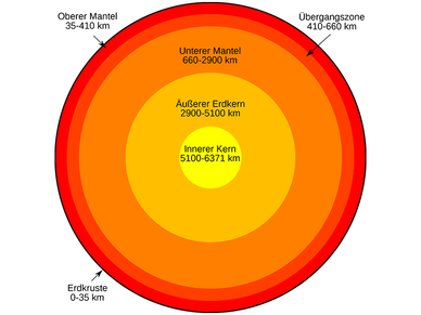
The shape of our Earth roughly approximates the shape of a ball (actual radius 6,357 to 6,378 km), the interior of which is made up of several shells: At the centre, there is the solid inner core with a radius of about 1,250 km, which consists mainly of iron and nickel. This is followed by the liquid outer core (mainly iron) with a radius of about 2,200 km. On top of that, there is a 2,900-km thick layer of viscous rock (silicates and oxides), referred to as the mantle, and the uppermost, relatively thin, solid crust. This also consists of silicates and oxides, but is enriched with elements that are not found in the mantle rock. With its shell-like structure, the Earth is a prototype of the four terrestrial planets in the inner part of our solar system.
Seismology reveals the Earth’s interior by analysing waves
Seismology strives to map the Earth’s interior in three tomographic dimensions. Hot and cold mass flows are visualised through the anomaly of the velocity of seismic waves. Once the resolution is improved further, it will be possible to visualise the material flows in the mantle, which are firstly the drivers of plate tectonics and secondly part of the geodynamo that generates the Earth’s magnetic field.
Seismograms
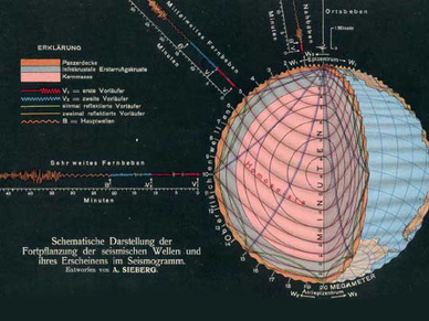
Seismic waves that either run through the Earth or propagate along the surface are recorded using seismographs (also referred to as seismometers). The travel times and amplitudes of these waves allow conclusions to be drawn about the Earth’s internal structure. The seismic characteristics at a given geographical location are described by the seismicity. The geographical location of seismic centres is visualised in diagrams (beachball plots).
(Source: Wikipedia)


