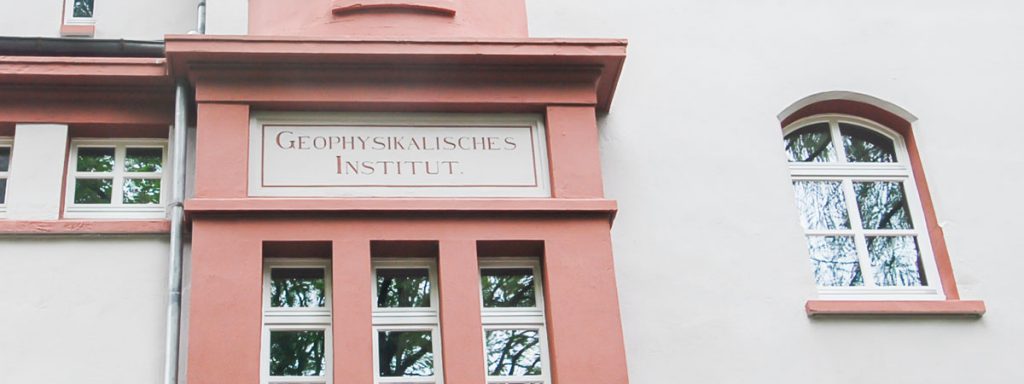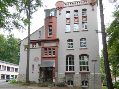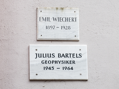
Former Institute of Geophysics
From 1901 to 2005 geophysics was domiciled on the grounds of the earthquake station
Historical Earthquake Station | Buildings & Site
Former Institute of Geophysics
100 years of history
The Institute of Geophysics in Göttingen looks back on a history of more than 100 years. It was established in 1898 as the first institute of its kind – but geophysical research had already been conducted in Göttingen before: This is how Carl Friedrich Gauss (1777-1855) succeeded in making groundbreaking discoveries in the field of geomagnetism in the city on the Leine River.
Following the appointment of Emil Wiechert and completion of a seismograph, seismology became the main focus of work in the first half of the 20th century, and Göttingen evolved into one of the main stations in the international network for seismological research. Between 1901 and 2005, the Institute of Geophysics was domiciled on the site of the Wiechert Earthquake Station Göttingen.
Manfred Siebert: History of the Institute of Geophysics in Göttingen
Prof. Dr. Manfred Siebert wrote an extensive summary of the institute’s history.
Like other disciplines that were late to emerge as independent fields of study, geophysics existed long before it was recognised as such. This was also the case in Göttingen, where soon after the university’s establishment in 1737 the fields of scientific research also included those which are today allocated to geophysics. These include the studies of atmospheric electricity conducted by Georg Christoph Lichtenberg and the geomagnetic studies of astronomer Tobias Mayer, who can hardly be mentioned without adding that he was referred to by Gauss as “Mayer immortalis”.
This most significant predecessor of Carl Friedrich Gauss as the director of the observatory, even before Alexander von Humboldt, may have already contributed to Gauss’ early interest leading to such fundamental scientific research into geomagnetism. In any case, the continuous history of geophysics in Göttingen began in 1832, when Gauss, then 55 years old, started to turn his attention to geomagnetic problems. His method for the absolute measurement of the magnetic field strength and his “General Theory of Geomagnetism” are only the most prominent results of a much broader and very extensive engagement in this field. For our subject, however, it is even more significant that the magnetic measurements and observations, in which Wilhelm Weber was substantially involved, called for a “respectable locality”, as Gauss put it, i.e. for a geomagnetic observatory. It was built as early as 1833, and “everything otherwise made of iron was made of copper”, as Gauss emphasised. The Göttingen Institute of Geophysics originated from it 65 years later. But initially, between 1836 and 1841, the observatory was the centre of the “Göttingen Magnetic Association”, where a total of 53 observatories, among them 18 outside Europe, worked together by checking the readings of their magnetometers every 5 minutes Göttingen time on agreed days. The results of this first large-scale international collaboration in the field of geophysics were published by Gauss and Weber, along with scientific articles of their own and of other authors, under the title “Results of the observations of the Magnetic Association”.
Emil Wiechert comes into play
It is owed to the observatory’s existence and Weber’s interest in magnetic measurements that geomagnetism remained a field of work of the Göttingen Observatory even after Gauss’ death in 1855.
When the observatory was split into two departments in 1867, geomagnetism, along with theoretical astronomy, geodesy and mathematical physics, was allocated to department B, with Ernst Schering as its director. Schering advanced the geomagnetic studies by developing his own instruments; under his direction, the observatory participated in the programme of the First International Polar Year 1882/83.
When looking at this first phase of geophysics in Göttingen lasting for more than half a century, it becomes apparent that it was closely linked with physics and mathematics from the very beginning, which was also maintained thereafter.
Soon after Schering’s death in 1897, the geomagnetic department was separated from the observatory, initially with the aim of expanding the observatory established by Gauss and Weber into a geomagnetic institute. In February 1898, Emil Wiechert was made its director after he had been appointed to the newly created Chair of Geophysics on 28 January 1898, initially as associate professor, becoming full professor in 1905. By decree of 2 July 1898, the government of the Kingdom of Prussia approved the renaming of the observatory to the “Institute of Geophysics”. A detailed description of the new institute and its history is provided by Wiechert himself (1906).
It should also be mentioned that Felix Klein, who substantially contributed to advancing the development of mathematics and physics in Göttingen at that time, was also involved in the extension of the Institute of Geophysics. The outward expression of this was the provision of a 17,300-m² area on the Hainberg hill to serve as the institute’s grounds, where the erection of a number of buildings and measurement huts was started in 1899.
Worldwide recognition through change from geomagnetism to seismology
The main building was occupied in 1901; in 1902, Gauss’ “respectable locality” was also relocated from the garden of the observatory to its present location on the institute’s site, where the Gaußhaus is still used today. Back then situated far enough from the developed urban area, today the institute is located directly on the edge of the city.
Emil Wiechert (1861-1928) had already gained an excellent reputation as a physicist with his fundamental studies into elastic aftereffect, cathode rays and electrodynamics, which he started in Königsberg and initially also continued in Göttingen, before he was appointed to the Chair of Geophysics, which then became his primary field of work. However, he had also already addressed the questions of mass distribution in the Earth’s interior and the existence of a core during his time in Königsberg. Although Wiechert wanted to branch into all fields of geophysics, this could not be implemented at an institute that started out with only three permanent posts (director, assistant and housekeeper). While still in the construction phase, seismology turned out to be the main field of work. This tendency was enhanced when, after completion of the Old Earthquake Vault in 1902 and the subsequent setup of the seismographs, whose development had partly already been started at the observatory, Göttingen also became one of the main stations in the international network for seismological research in 1905. This defined the institute’s specific field of work for nearly half a century.
This change from geomagnetism to seismology quickly earned the new institute worldwide recognition. Wiechert succeeded in constructing automatically recording seismographs, whose mode of action was theoretically predictable. They made it possible for the first time to obtain seismograms that allowed definite conclusions to be drawn about the movements of the ground as well as the identification and analysis of various seismic waves, not least thanks to a novel air damping system.
The heavy San Francisco earthquake of 18 April 1906 was already recorded and marked the beginning of the nearly uninterrupted recording of earthquakes with the Wiechert seismographs for about 90 years. Wiechert and his team also played a major role in solving the theoretical problem of identifying the course of seismic waves through the Earth’s interior and the corresponding propagation velocities based on their travel times from the epicentre to the stations. The theoretical solution to this so-called inverse problem was delivered in 1907 by mathematician Gustav Herglotz (also developed independently by Harry Bateman in 1910), who lived in Göttingen at that time, after he had recognised that the problem could be traced back to an Abel integral equation. Based on Herglotz’ work, Wiechert presented a practical method to calculate the velocities of the seismic waves as a function of depth based on observations on the Earth’s surface. This created the prerequisites for the detailed seismic exploration of the Earth’s interior.
Locating mineral deposits using the “seismic exploration method”
This undertaking was facilitated by the establishment of a Geophysical Observatory in 1902 in Apia on Upolu, one of the Samoan Islands that belonged to the former German protectorate. Owing to this undertaking, which was initiated and actively promoted by Göttingen-based geographer Hermann Wagner, the Institute of Geophysics had an outpost until after World War I which was equipped with the same instruments and was close to its antipode, apart from a difference of about 40° in latitude.
To learn more about the history of the Samoa Observatory, please go to Angenheister (1974).
We cannot address here the many resulting individual findings, which led to new, fundamental insights into the structure of the terrestrial body, or Wiechert’s individual staff members, who made such a substantial contribution to these findings that they are also referred to as the “Göttingen School of Seismology”. At this point, we would like to only mention two of them: Beno Gutenberg calculated the correct value of 2,900 km depth for the boundary between the Earth’s core and mantle in 1913 after the existence of this boundary and thus also the existence of the core had been proved in previous evaluations of seismograms. Ludger Mintrop established the method of seismic exploration of the uppermost layers of the earth using artificial earthquakes and portable seismographs in 1908. The 14-m scaffolding and the 4-t iron ball, which was dropped to generate ground shocks, are still located on the institute’s site. A detailed description is provided by Meyer (1974).
The transition to the seismic exploration method was soon made, initially with the goal of continuing the geological surface mapping into the depth (Schulze 1974). By now, this method for locating mineral deposits, into which tremendous technical effort was invested, has gained the known economic and even global political significance.
Behind seismology, atmospheric electricity, and along with it, meteorology, was the second most important field of work, which also applies to the Samoa Observatory, where geomagnetic measurements and recordings were conducted as well. The systematic investigation of the anomalous propagation of sound waves, which started in 1923 and was facilitated by the demolition of ammunition dumps after World War I, represented a both attractive and fruitful combination of seismic and atmospheric problems, formerly also referred to as air seismology. The application of the Wiechert-Herglotz method to the travel times of such sound waves, which made their way through the stratosphere from the source to the observation stations, resulted in the detection of a layer of warm air where the temperature rises to values comparable to those on the ground and the mean height of which was then estimated at 40 km, which is 10 km less than what is known today.
Such successes are almost always based on successfully opening up new fields of research using novel methods. When Wiechert died in 1928, many ‘effects of first order’ in his field of work had been indentified and largely understood. A comprehensive list can be found in the obituary by Angenheister (1927/28). The abundance of detailed questions arising in this context still gives rise to further investigations.
The Bartels era
The institute continued to address these questions under Wiechert’s successor, Gustav Angenheister (1878-1945). He was a student and assistant of Wiechert’s and the last head of the Samoa Observatory between 1911 and 1921, becoming its director in 1914. The main fields of work in the 1930s included, in particular: study of the seismic surface waves, seismic survey of the underground for mining and construction purposes, participation in the geophysical survey of the Reich and expansion of meteorological research in collaboration with the Göttingen Kaiser Wilhelm Institute for Fluid Dynamics Research. Due to the outbreak of World War II, the planned extension of the institute and other projects had to be put off; the war also generally influenced and affected the institute’s work.
The death of Angenheister shortly after the end of the war in 1945 caught the institute in an already tense situation. In view of this, it can be seen as a fortunate coincidence that, owing to the post-war turmoil, Julius Bartels (1899-1964), who did not have a job at that time, agreed to succeed Angenheister and was able to take office immediately.
Bartels was appointed to the Chair of Geophysics as associate professor in 1946 and as full professor in 1950, after he had already served as full professor at the University of Forestry in Eberswalde and the Friedrich Wilhelm University in Berlin and as Director of the Geophysical Institute in Potsdam. When Bartels returned to Göttingen in 1945, his original place of study, he had already gained worldwide reputation as a scientist, not least due to the standard work entitled “Geomagnetism”, which he wrote together with Sydney Chapman and published in 1940. His main field of interest was the application of mathematics to geophysical problems, in particular the application of statistics to meteorological and geomagnetic observation series with groundbreaking contributions to statistical methods. This limited but essential information about his person is sufficient to make clear that the appointment of Julius Bartels as the director brought about a change in the institute’s main fields of work and research: Geomagnetism again became the central field of research.
At first, however, the institute devoted itself to a major task for which it had been well prepared due to its past, namely the seismic exploration method, more specifically the recording of the “big bang” in Heligoland on 18 April 1947. The evaluation of the recordings of 24 portable seismographs and the seismograms of several earthquake stations made it possible for the first time to connect the findings obtained with the seismic exploration method with those of earthquake seismology (Schulze 1974). Starting from the 1950s, however, the new fields of work were gaining ground: rock magnetism, geoelectrics, geomagnetic deep sounding, atmospheric and ionospheric tides in connection with the quiet geomagnetic variations Sq and L. The recording of the variations and pulsations of the Earth’s magnetic field was started, from 1957 in a new building on the institute’s site. In addition, the Göttingen Service of Geomagnetic Indices began in 1951 as part of the International Service of Geomagnetic Indices, which will be addressed later on. Occasional investigations into other fields contributed to the diversity of subjects.
The International Geophysical Year 1957/58
Collaboration was maintained in particular with the Max Planck Institute for Ionospheric Physics in Lindau am Harz, the German Hydrographic Institute in Hamburg and the Lower Saxony State Office for Soil Research in Hanover. The North German conductivity anomaly, along with its specific tasks for field measurements as part of geomagnetic deep sounding and later on also magnetotellurics as well as model calculations on the basis of electromagnetic induction, increasingly turned out to be the central subject of research. The investigation of atmospheric tides, a field which lies somewhere between geophysics and meteorology, led to the refutation of the so-called resonance theory, which had been accepted for more than half a century, and to a new idea of the thermal excitation of this phenomenon.
The International Geophysical Year 1957/58, an outstanding event which had been prepared for years, also took place at that time. The Göttingen institute benefited from this undertaking for two reasons. Firstly, the new fields of work were directly related to the agreed research programmes; secondly, Bartels was one of the initiators of this project and chairman of the corresponding German state committee. Moreover, in addition to being the Director of the Göttingen institute, he was also appointed the Director of the Max Planck Institute for Stratospheric Physics in Lindau in 1956, which was very beneficial, especially for the working conditions at the Institute of Geophysics.
Finally, the discovery of the magnetosphere beyond the ionosphere and the solar wind constantly released from the sun – both initially indirectly – marked the beginning of a virtually new era in understanding geomagnetic interferences, adding the possibility of direct extraterrestrial measurements that opened up in 1957 with the start of the first satellite Sputnik I. Under these conditions and due to the continuation of the international joint undertakings, a substantial part of the institute’s work was predetermined. For example, Bartels was again greatly involved in the preparation of the International Years of the Quiet Sun 1964/65, but he was denied having a share in the results due to his unexpected death on 6 March 1964. Geophysics in Germany lost in him one of its most outstanding and internationally most renowned personalities, as emphasised in all obituaries (Chapman 1964, Dieminger 1964, Kertz 1964).
The resulting new situation had a lasting impact on the institute and the author of this contribution. Being the longest-serving assistant, initially without a habilitation, I was entrusted with the institute’s management, where about 20 doctoral, degree and state exam candidates were busy completing their theses in extremely confined space, and no one anticipated that the position would this time remain vacant for four and a half years. In an effort to find a successor among Bartels’ students, first Walter Kertz in Brunswick and then Gustav Angenheister in Munich were asked.


